
Why the African Union Introduced a New Map of Africa — And Why It Matters to the World
For more than four centuries, the world has looked at Africa through a map that did not tell the full truth. In classrooms, newsrooms and international publications, the continent has often appeared much smaller than it really is, creating a visual misconception that has quietly shaped how generations understand Africa.

By: Ebenezer Adugyamfi & Emmanuel Ayiku for GhanaianNewsCanada September 7, 2026
For more than four centuries, the world has looked at Africa through a map that did not tell the full truth. In classrooms, newsrooms and international publications, the continent has often appeared much smaller than it really is, creating a visual misconception that has quietly shaped how generations understand Africa. 
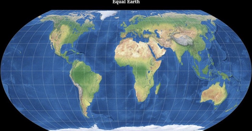
The African Union has now taken a historic step to change that narrative by introducing a new official map based on the Equal Earth projection. Rather than redrawing borders or changing the shape of countries, the new map corrects the way Africa is represented, showing the continent in its true geographical proportions.
Why was a new map necessary?
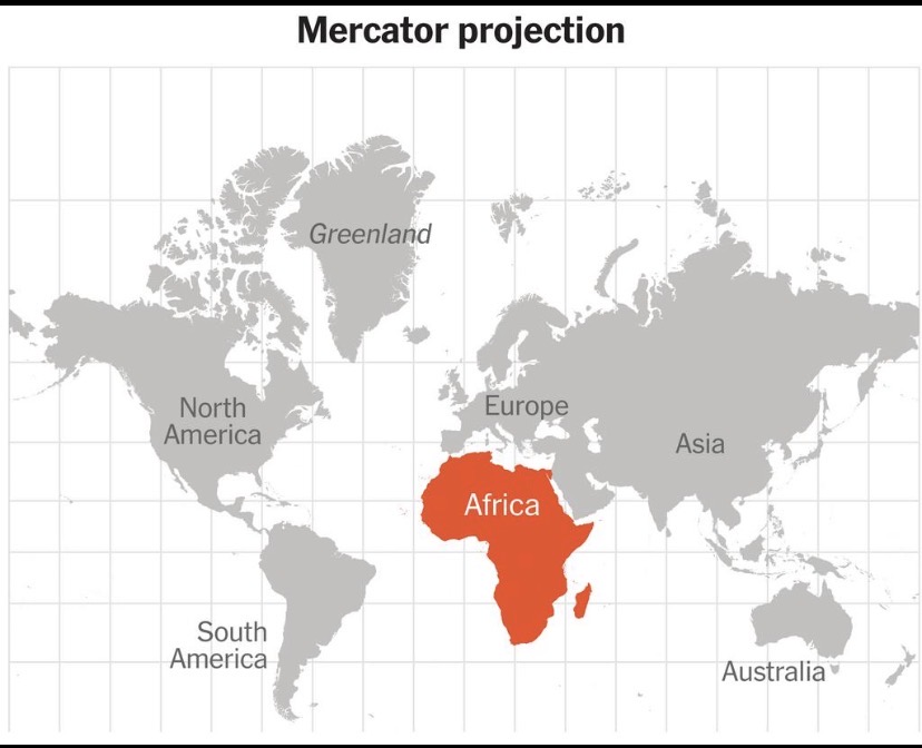
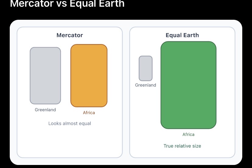
The AU believes maps are more than educational tools—they influence how people perceive power, opportunity and importance. The widely used Mercator projection, created in 1569 for maritime navigation, enlarges regions closer to the North Pole while shrinking land around the equator, making Africa appear disproportionately small beside Europe and Greenland. 
In reality, Africa covers more than 30 million square kilometres, making it the second-largest continent on Earth. The entire United States, China, India, Japan and much of Europe could fit within Africa’s landmass, yet traditional world maps rarely communicate that reality.
A correction, not a political redraw
One of the biggest misconceptions surrounding the new map is that Africa’s borders have changed. They have not.
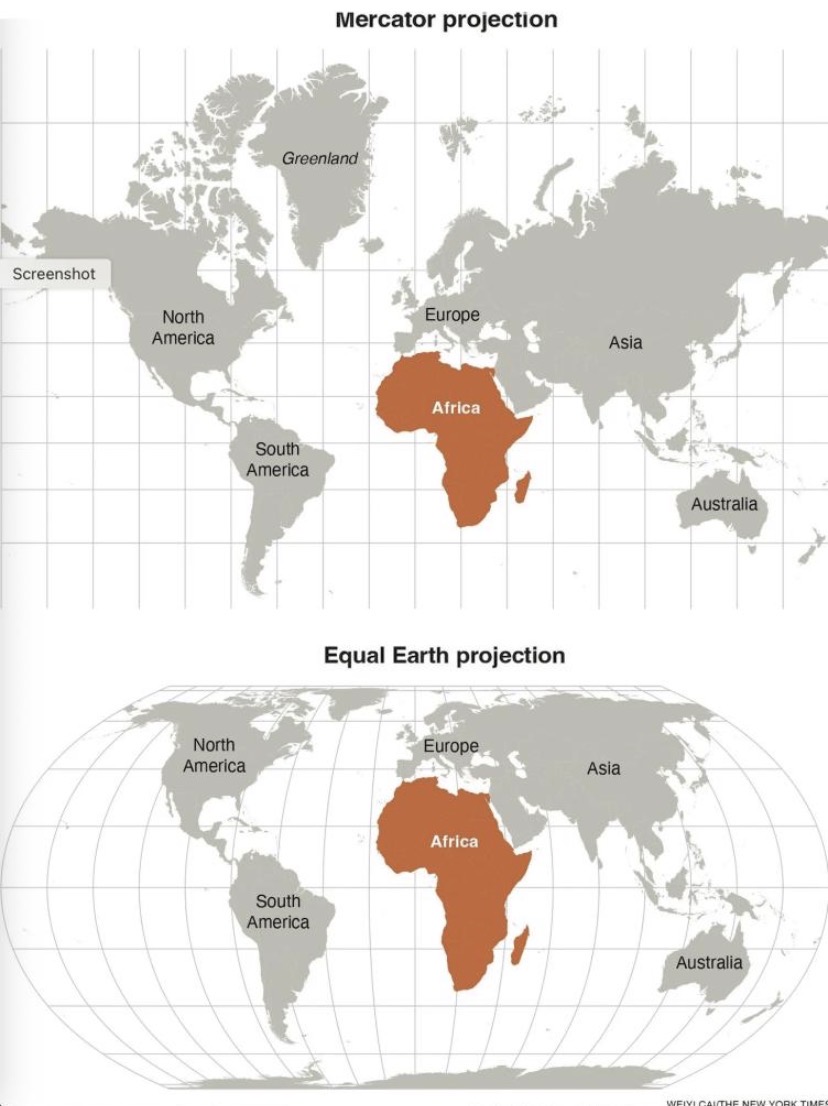
Every international boundary remains exactly the same. What changes is the projection—the mathematical method used to display the curved surface of the Earth on a flat map. The Equal Earth projection preserves the relative size of continents far more accurately, allowing Africa to appear as large as it truly is.
The AU’s message: restore Africa’s true image
The decision is part of the African Union’s broader Correct the Map initiative, which argues that centuries of distorted cartography have contributed to an equally distorted understanding of Africa’s economic potential, cultural diversity and global significance. The Union says correcting the map is an act of historical accuracy rather than symbolism alone. 
By adopting the Equal Earth projection, the AU is encouraging all 55 member states to gradually revise school textbooks, atlases, educational materials and official publications so that future generations grow up seeing Africa as it truly is.
What happens next?
The campaign is expected to extend beyond Africa’s borders. The AU wants international organisations, publishers, universities, media outlets and technology companies to embrace more accurate world maps, especially in educational and public information materials. Maritime and aviation navigation will continue using the Mercator projection where it remains technically appropriate. 
For Africans at home and in the diaspora, the new map represents something deeper than geography. It is a reminder that how a continent is portrayed can influence how it is valued, and that correcting a centuries-old image is also a step toward correcting a centuries-old perception.
Editor’s Note
This is an original explanatory feature written for GhanaianNewsCanada, based on publicly available information about the African Union’s “Correct the Map” initiative and the adoption of the Equal Earth projection. It is written in GhanaianNewsCanada’s editorial style rather than adapted from another news outlet.

